
| BACK to CATISFIELD Maps index page.. |
Catisfield - In Maps: 1898 Compared with Today |
Forward to NEXT Map. |
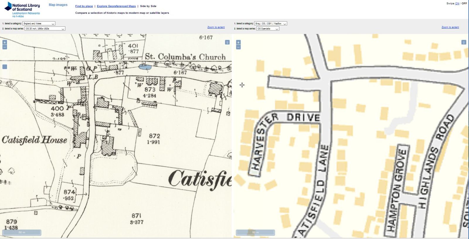
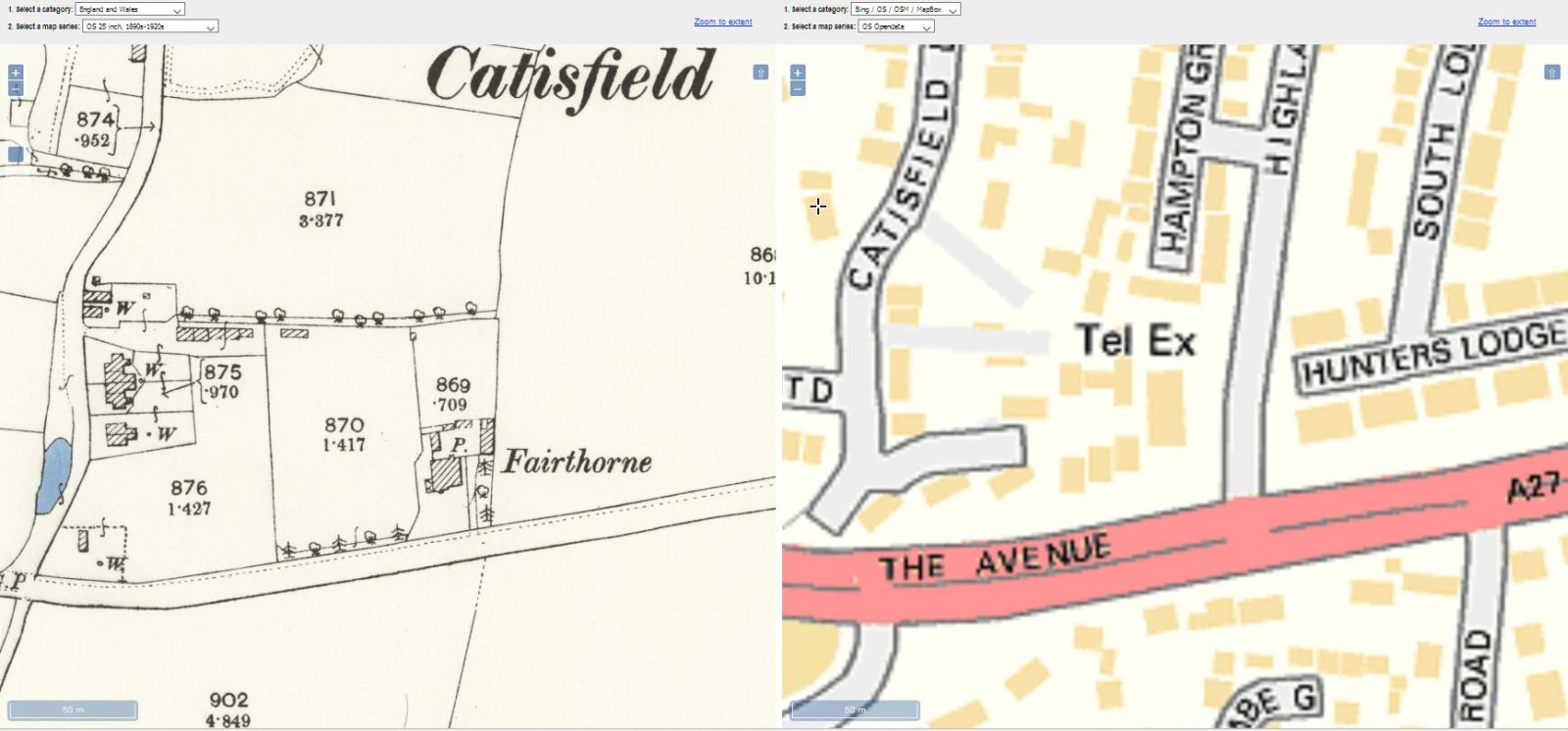
The National Library of Scotland offers a very neat tool for comparing old and new maps.
It allows you, for example, to put on the same screen an old map such as the 1898 OS alongside a modern street map showing every preent-day house..... You can zoom them in exact tandem, or move across, up and down in synch.
These are screen captures from the tool for Catisfield, showing Catisfield 'central', 'south' and 'east'.
more text and explanation to go here.....
| BACK to CATISFIELD Maps main page.. go back to Top of this page |
Catisfield pages originally 'on the web' January 1996 Most recent revision: 27 Feb 2017 © Doug Glading ..... 1996-2017 |