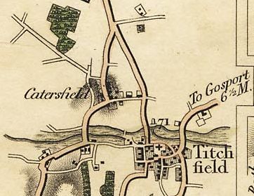
*
BACK to CATISFIELD Maps index page..

Catisfield - In Maps: 1814 to 30

Forward to NEXT Map.

.

There varous maps in this period covering Catisfield (or 'Catersfield' as it appears in these).

There aren't really many detailed maps - these extracts may come from for example maps of Hampshire. Dates often don't actually reflect when they were mapped / drawn.

Many are similar and may well be details copied from map to map. (And in some cases there are opmimistic details, such as a map which exists showing the Fareham-Southampton railway running SOUTH of Titchfield !)


Mogg's Map of 1814.

This map shows some buildings on the east side of Catisfield Lane, down towards its junction with the Avenue.

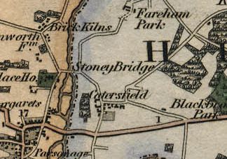
Greenwood's Map of 1826.

This map shows more housing south of the stretch of Catsfield Lane leading to Highlands Road. It doesn't show the buildings that Mogg does, but it does show a larger house and grounds east of Catisfield Lane - presumably which are Elmshurst
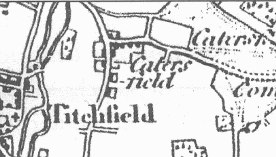
Map of 1830.


From a book about the Titchfield Canal. The map is entitled "Titchfield, the River meon, the Canal and Hill Head as known about 1830" 


This extracted section above shows "CATERSFIELD".
Although this is said to be a map of 1830 it does not show the Turnpike (built 1811).
Otherwise this map is very similar to the map of 1810.

..

>I >more text and explanation to go here.....

BACK to CATISFIELD Maps main page..


go back to Top of this page
 ...his mark
Comments, queries and messages to:

Catisfield pages originally 'on the web' January 1996
Most recent revision: 22/2/2017
      © Doug Glading ..... 1996-2017