
Last update 4/9/2023
All corrections and additional information welcome< Doug Glading
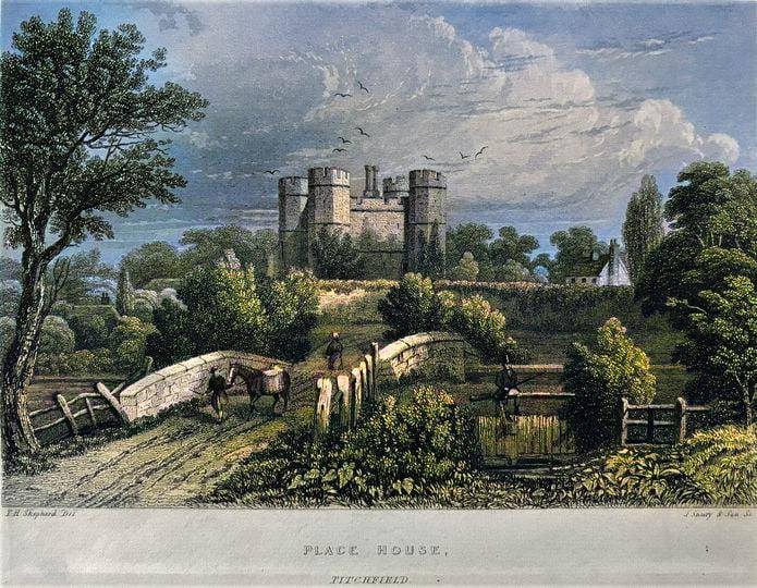
Fishers Hill leads up from the River Meon to the village of Catisfield, starting opposite Titchfield Abbey (aka Place House).
It has also been known as Stoney Bridge Hill and Catisfield Hill.
The route across Stoney Bridge and on to Catisfield - the first historic crossing point of the River Meon - has been traversed for centuries .
· Monks from Titchfield Abbey crossed the Meon on foot or horseback as they perambulated across England as far as Kent and Yorkshire.
· Drovers herded their sheep and cattle up the hill en route to the Royal Navy victualling facilities at Gosport
· Supplies stored in the Great Barn at Titchfield Abbey went up the hill to Gosport and Portsmouth.
· Henry VI in 1445 Henry VI & Margaret of Anjou are said to have gone up Fishers Hill, from Titchfield Abbey towards Southwick, after reconfirmation there of their marriage in France (So although the bridge is known as Anjou Bridge (even Iron Duke Bridge in some reports !!) - this crossing was way before the current bridge was actually was built )
· Bill Shakespeare c. 1592 - As a tutor at Place House the playwright must have walked around pondering his plots
· April 1662 -- Samuel Pepys went from Portsmouth to Southampton and back (so probably traversed Fishers Hill)
· ..
· [Of course Pepys was on a horse or maybe in a coach, and Henry in a posh carriage. ]
·
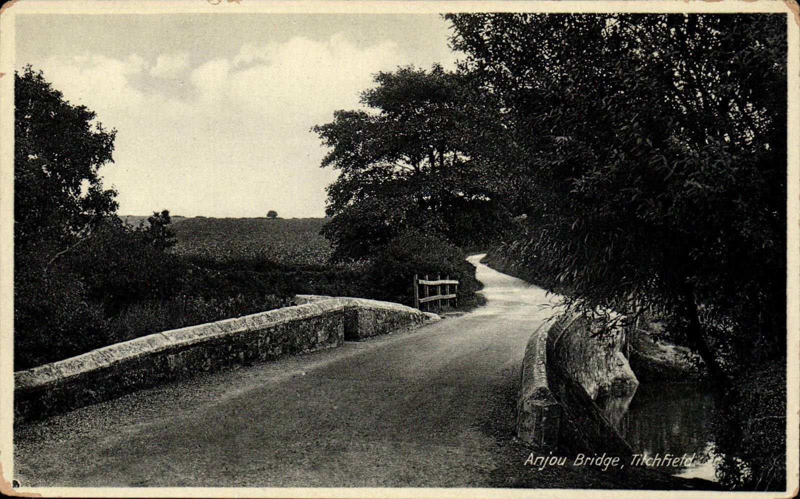
STONEY BRIDGE (aka Anjou Bridge)
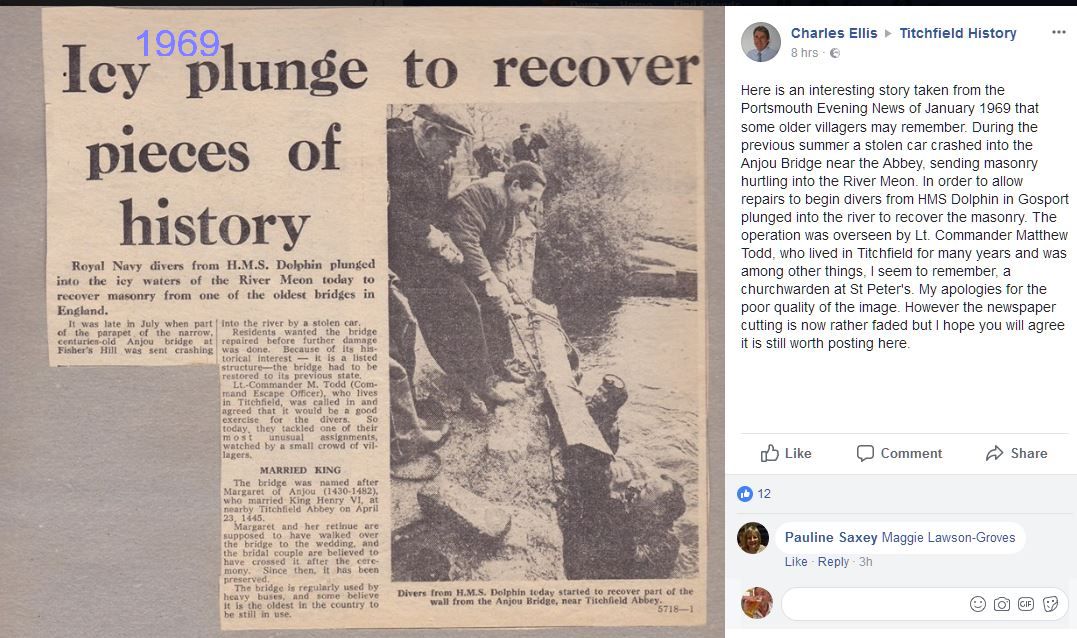
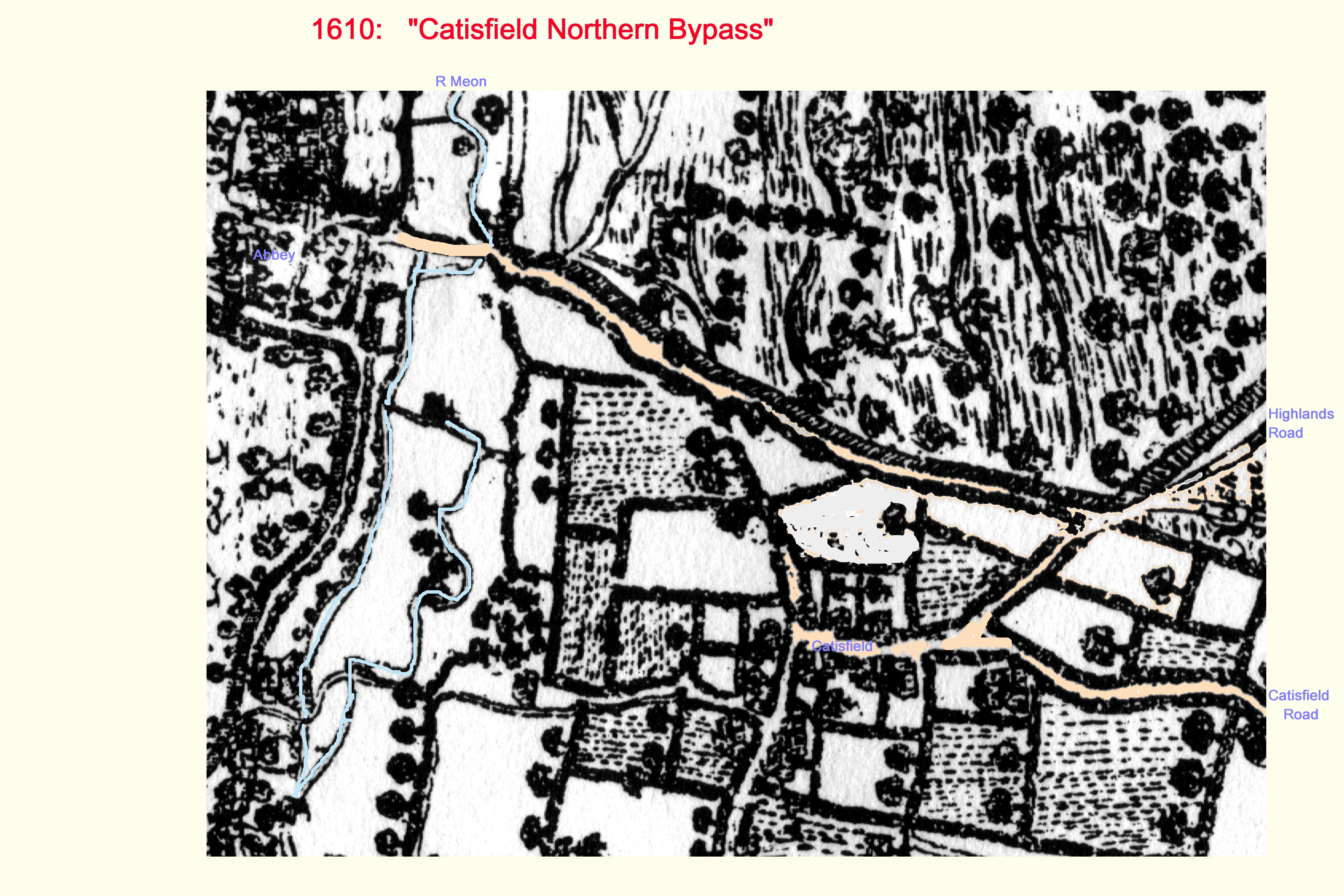
Stony Bridge is situated about 100m east of the entrance to the former Premonstratensian Abbey of St Mary and St John, and replaces a bridge built by the monks during the 14th century, which was probably made of stone piers and a wooden parapet The antiquary, John Leland reports that the bridge was made of wood when he crossed it in 1542. Stony Bridge was rebuilt in stone during the 17th century under Henry, the 3rd Earl of Southampton, whose grandfather had acquired the Abbey, from then on known as Place House, after the Dissolution of the Monasteries. Henry commissioned a survey of the estate, on which he had undertaken major works, and the 1610 map produced as a result shows `Stoney Bridge'. Local knowledge suggests that the date `1625' was inscribed on the bridge, but this is no longer visible. Stony Bridge is made of roughly coursed stone and comprises two arches, each with a 2.7m span. It is a Scheduled Monument, Listed Grade II and is also known as the Anjou Bridge, from the association with the marriage of Henry VI and Margaret of Anjou in 1445.. . |
click on any image to see larger version
|
||||||
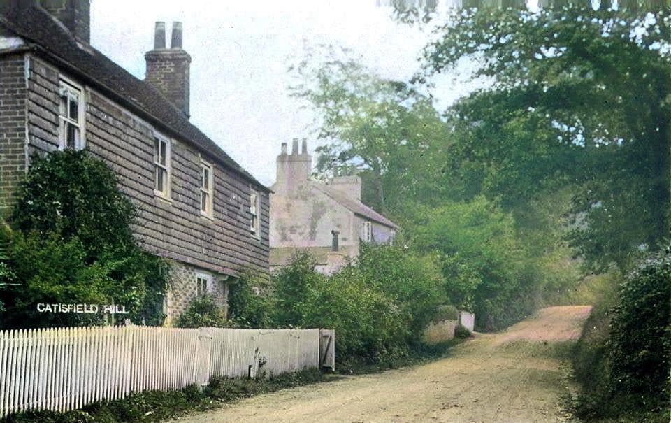
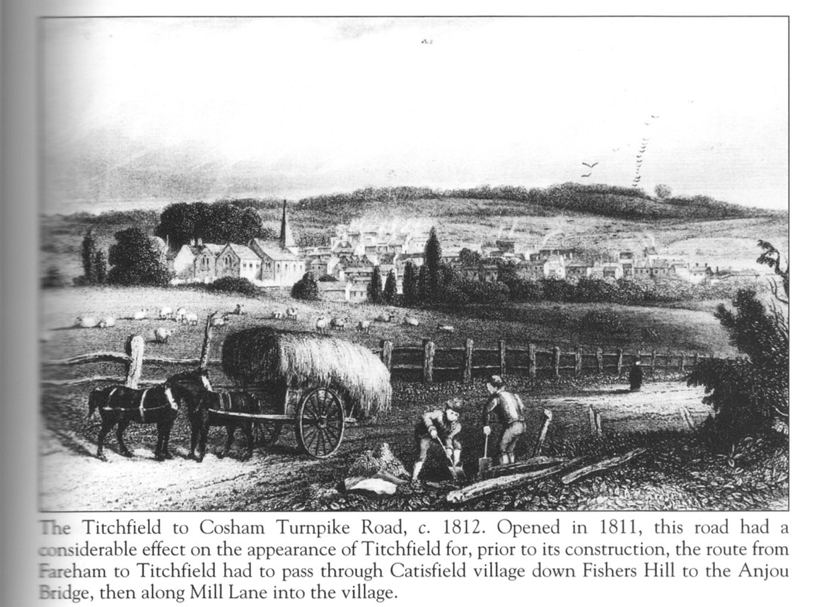
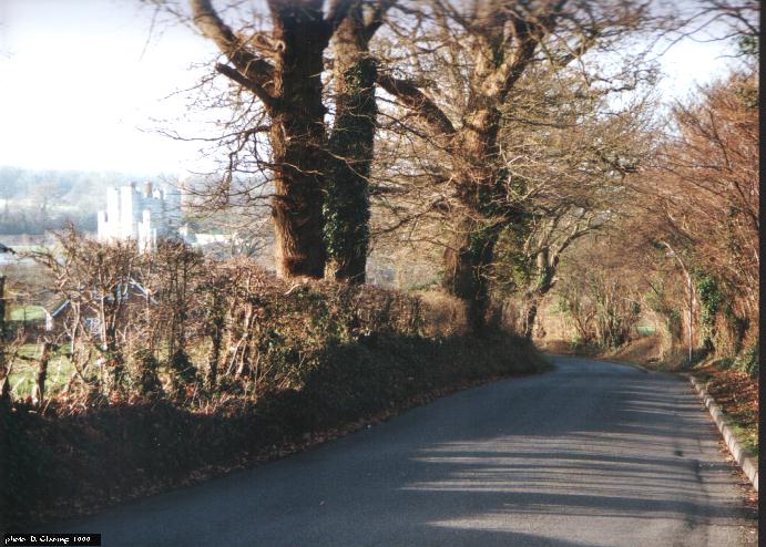
CATISFIELD HILL (aka STONEY /STONY BRIDGE HILL , later Fishers Hill)
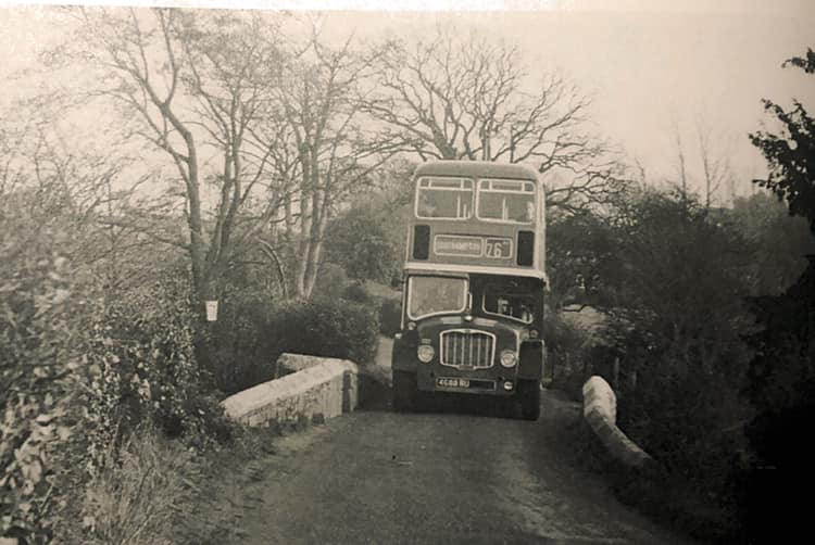
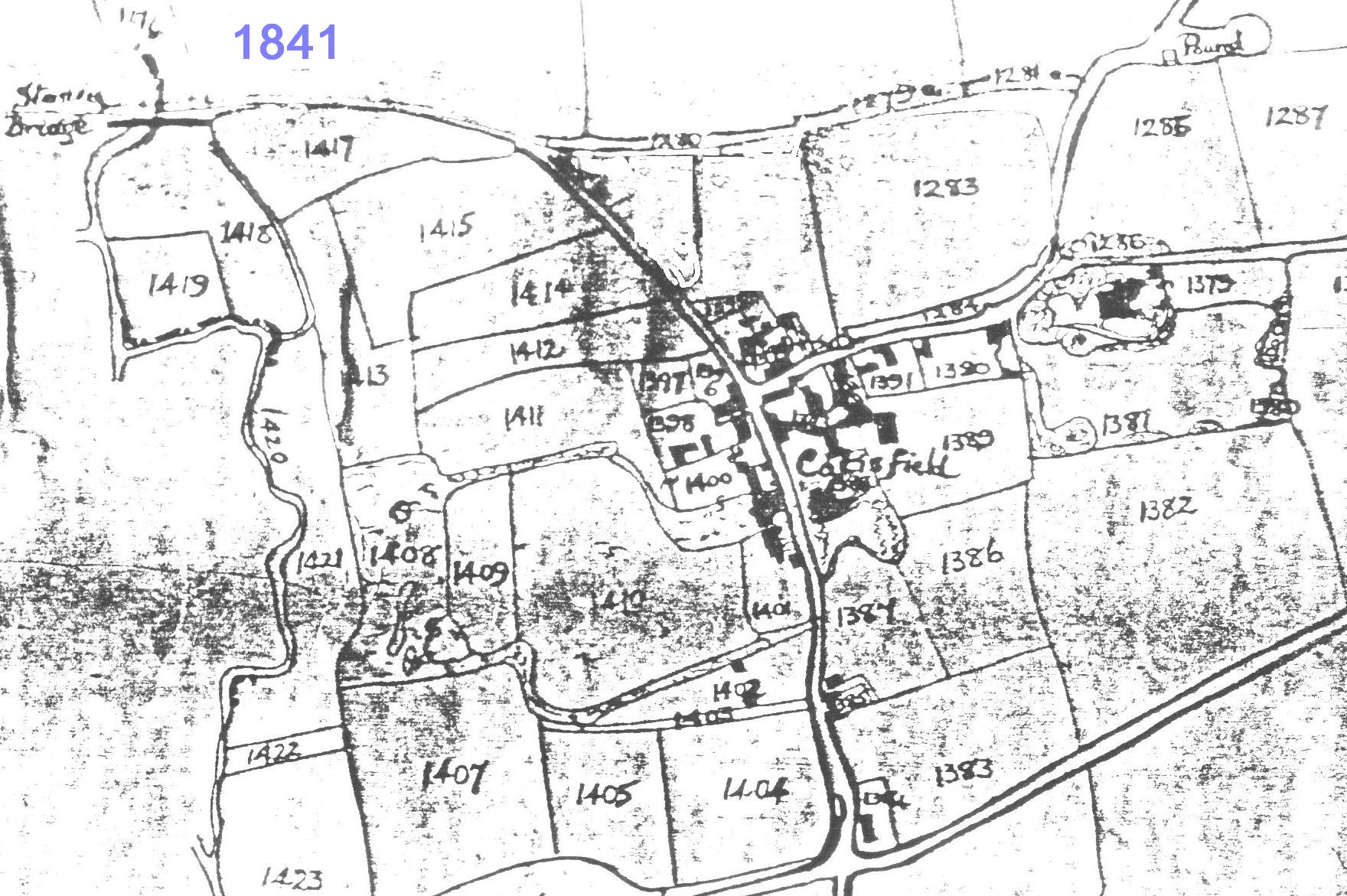
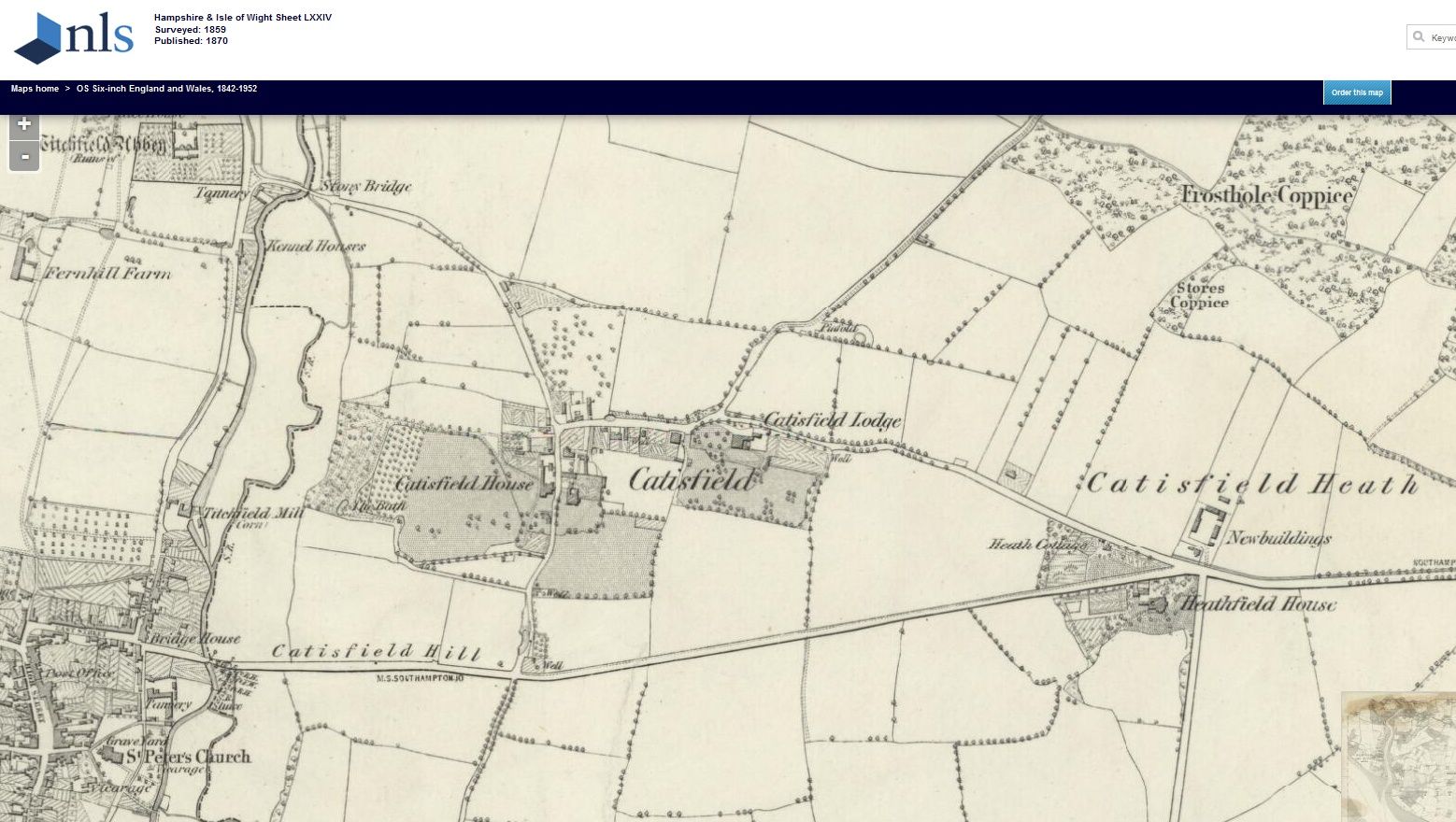
Gateway to the West - At one time All the Traffic East and West. Went up and down Fishers Hill. (Imagine that today: all the traffic of the M27 plus Rail plus A27 ..) The route from Fareham came past Blackbrook, over Catisfield Common and bore slightly right at the Peak Lane junction (by Heathfield Manor todays Oast & Squire) onto Catisfield Road. Then into or just past Catisfield, down Fishers Hill, left at the Abbey, past Titchfield Mill and into the village with a right turn by The Wheatsheaf. 1811 - On first of June the direct road from Heathfield /Peak Lane junction into Titchfield, entering past the tanneries and the Wheatsheaf, is said to have been opened. (This road down from the Catisfield Lane / Ranvilles Lane junction into Titchfield was also known as 'Catisfield Hill'.) This became part of the Titchfield and Cosham Turnpike Trust (Act was published in 1810 for a distance of 7miles 2 furlings and 180 yards), with Toll Houses at Blackbrook, East Cams and Wymering. Opened in 1826. So Catisfield was bypassed to the South. Fishers Hill stayed open as a country lane (not yet the rat run of later years )
|
click on any image to see larger version
|
||||||
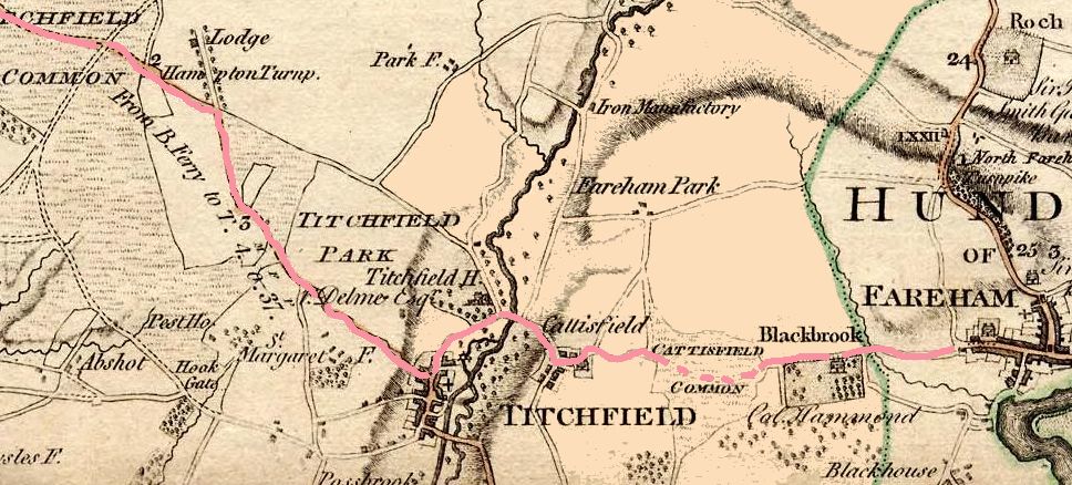
HIGHLANDS ROAD LINK (CATISFIELD NORTHERN BYPASS)
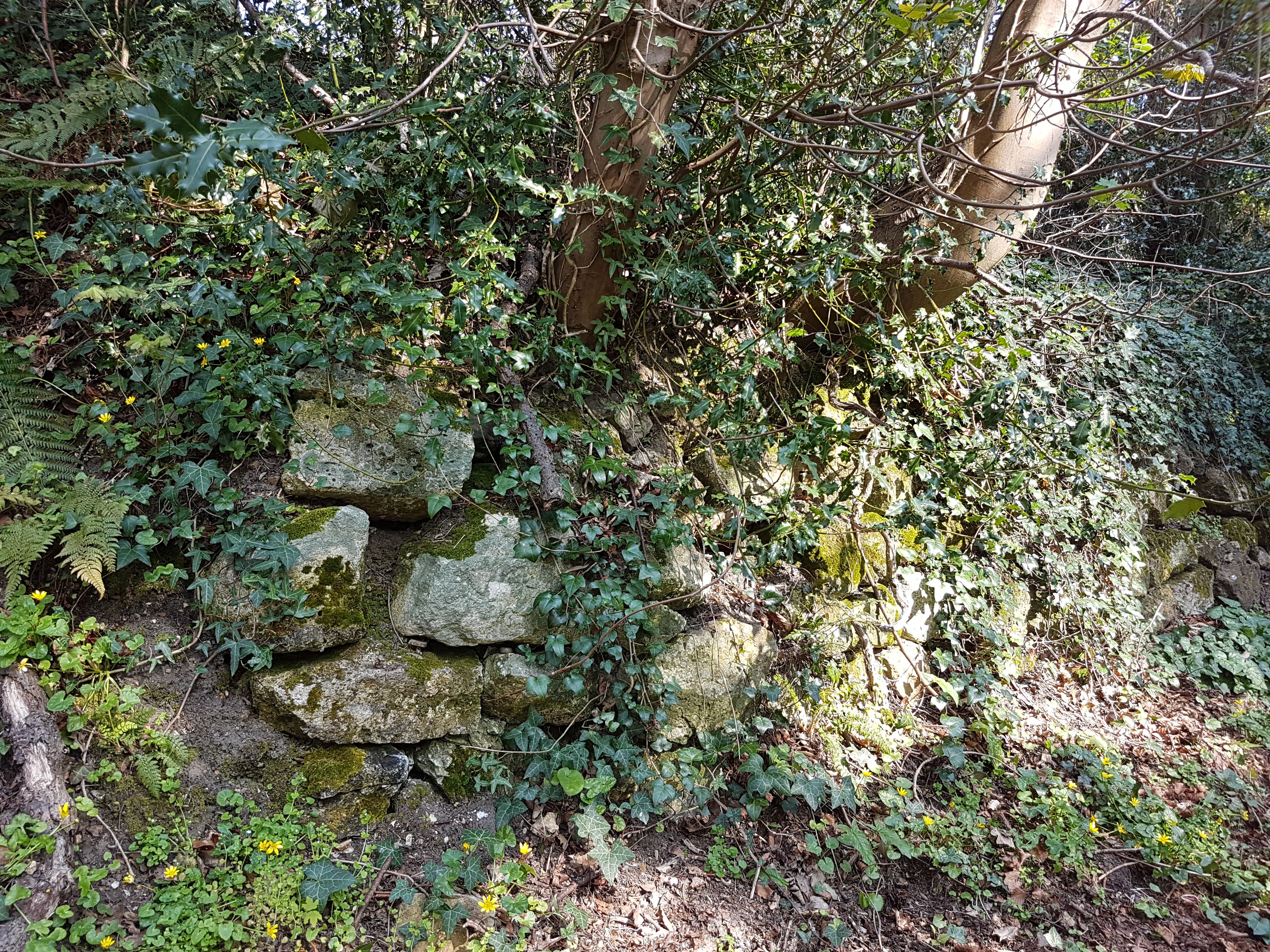
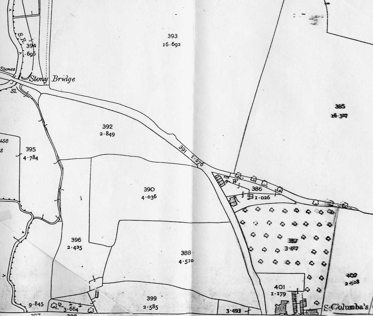
There was a period, depicted in some old maps, when Catisfield was actually bypassed to the North. Although Catisfield Lane is shown on them turning north by the Post Office to start a descent into the valley, it does not appear at this time to have joined with Fishers Hill. Instead Fishers Hill continued up almost in a straight line, across the rear of Anjou cottages, to join Highlands Road opposite Place House Close (location of the Catisfield Pound a staging post for the animals being driven to RN butchers at Gosport). The top part of Fishers Hill (the cutting above Orchards Cottage) appears on the maps of 1832 etc. This cutting could have been delayed due to funding, manpower and/or land ownership issues. Just above Orchard Cottage the cutting bank is reinforced with some old stones probably from Titchfield Abbey (or rather Place House, which was torn down 1781) The Conservation Area Assessment says it is not clear when this later link became established but it is likely to have been much earlier than 1810. This northern route, possibly a drovers track which bypassed the village, had disappeared by the mid C19 and is not marked on subsequent maps. So unfortunately Henry VI didnt actually go through Catisfield, - he just went by it. |
click on any image to see larger version
|
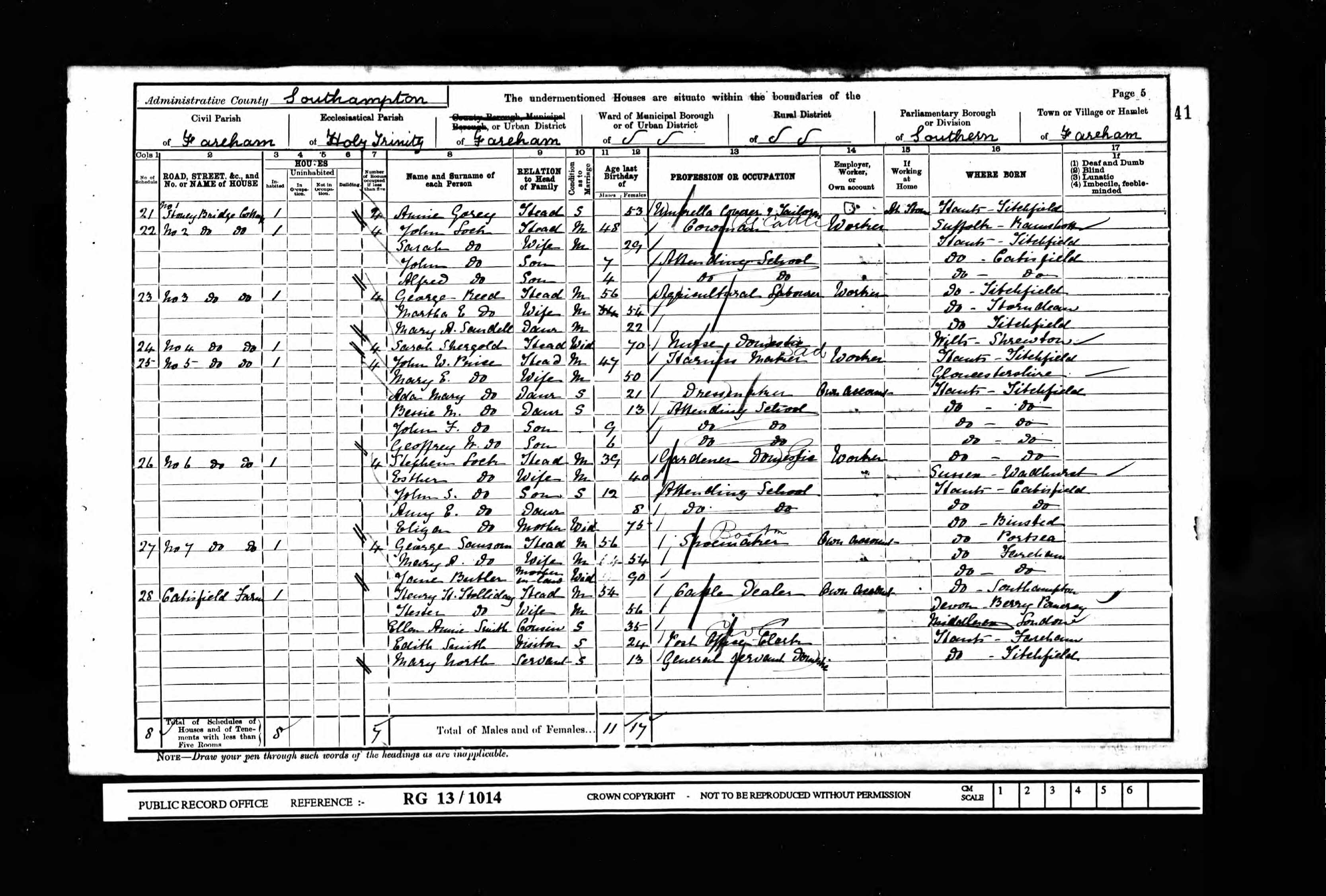
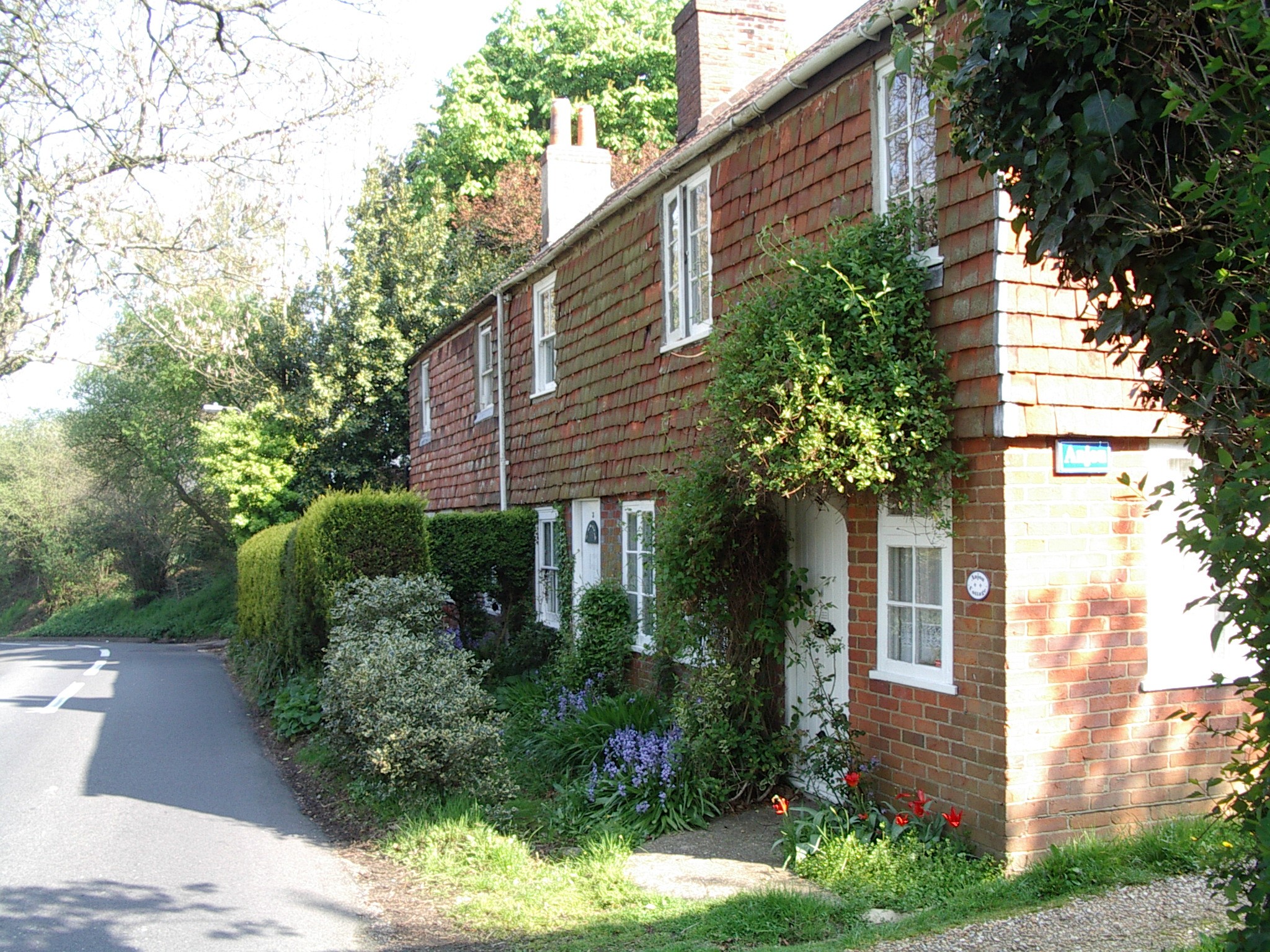
ANJOU COTTAGES (aka Stoneybridge Cottages ) Grade IIHalfway up Fishers Hill we find a small collection of homes an old small terrace of cottages plus Orchard Cottage (c. 1837) just above, and the slightly newer Merrill Cottage at the start of the (now vanished) Highlands Road link. The terrace is a listed Grade II Historic Building. The terrace and its individual cottages have had various names The 1901 census calls it Stoneybridge Cottages and lists 5 homes in it (plus 2 actually in Orchard Cottage) The 1911 census calls it Mount Pleasant and lists 4 homes (and 2 in the nearby Orchard Cottage). More recently the terrace was three homes: Huntsman, Broadheath and Anjou, and now is just two dwellings: Huntsman, and Anjou Cottages The two dwellings in Orchard Cottage and now just one. |
click on any image to see larger version
|
||||
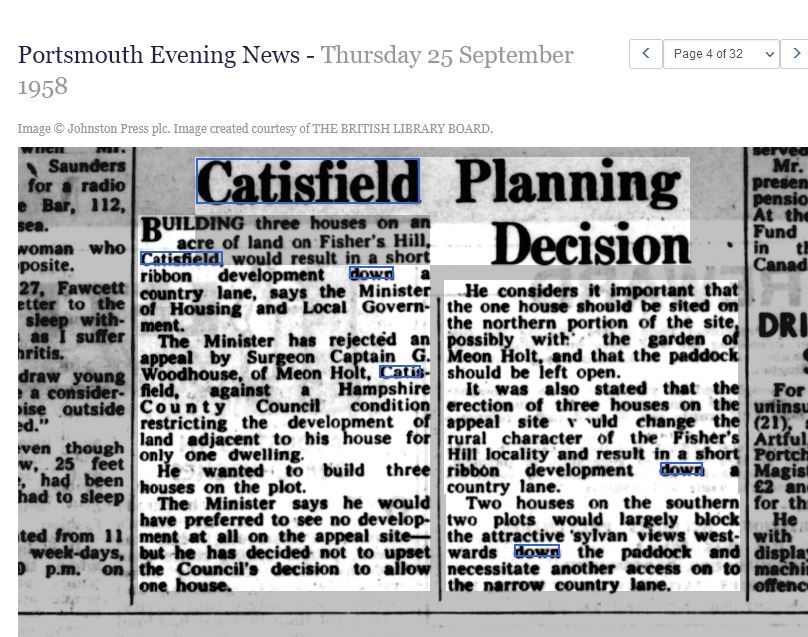
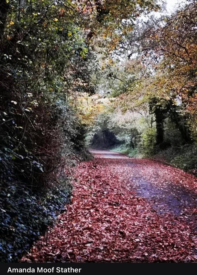
MEON HOLT & Kingfishersin 1955 and 1958: Surgeon Captain G. Woodhouse, of Meon Holt, Fisher's Hill, Catisfield, appealed against a planning decision re the development of one acre adjacent to his house for only one dwelling. He proposes to build three houses on the plot. The counsel for the planning authority said: Fisher's Hill, a pretty country lane leading down to the old Anjou Bridge over the Meon, was a favourite local walk. . Permission was given for the erection of one house only. |
click on any image to see larger version
|
||||||
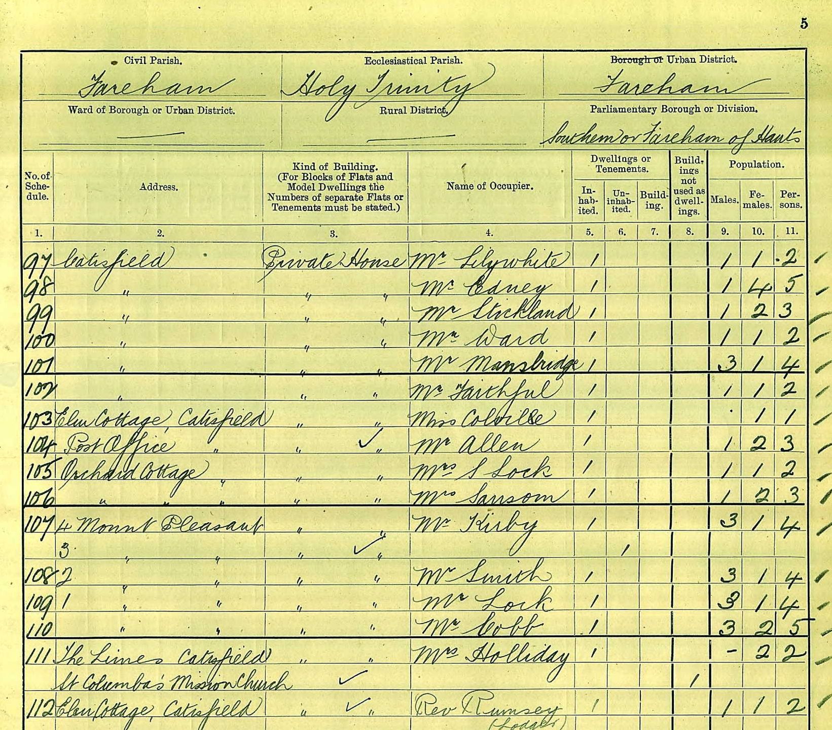
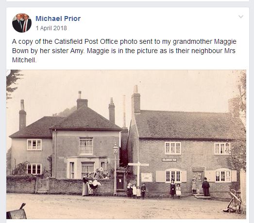
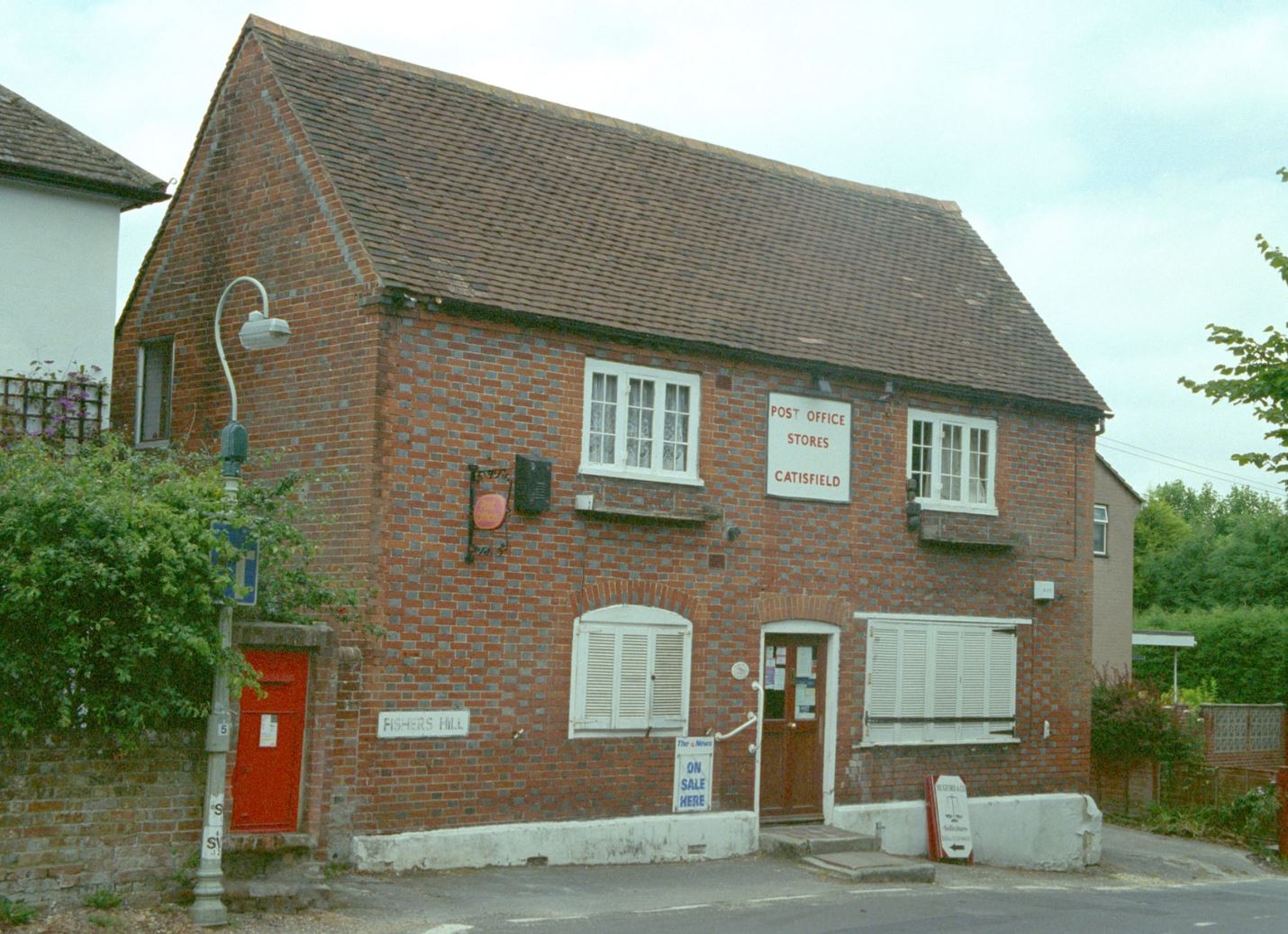
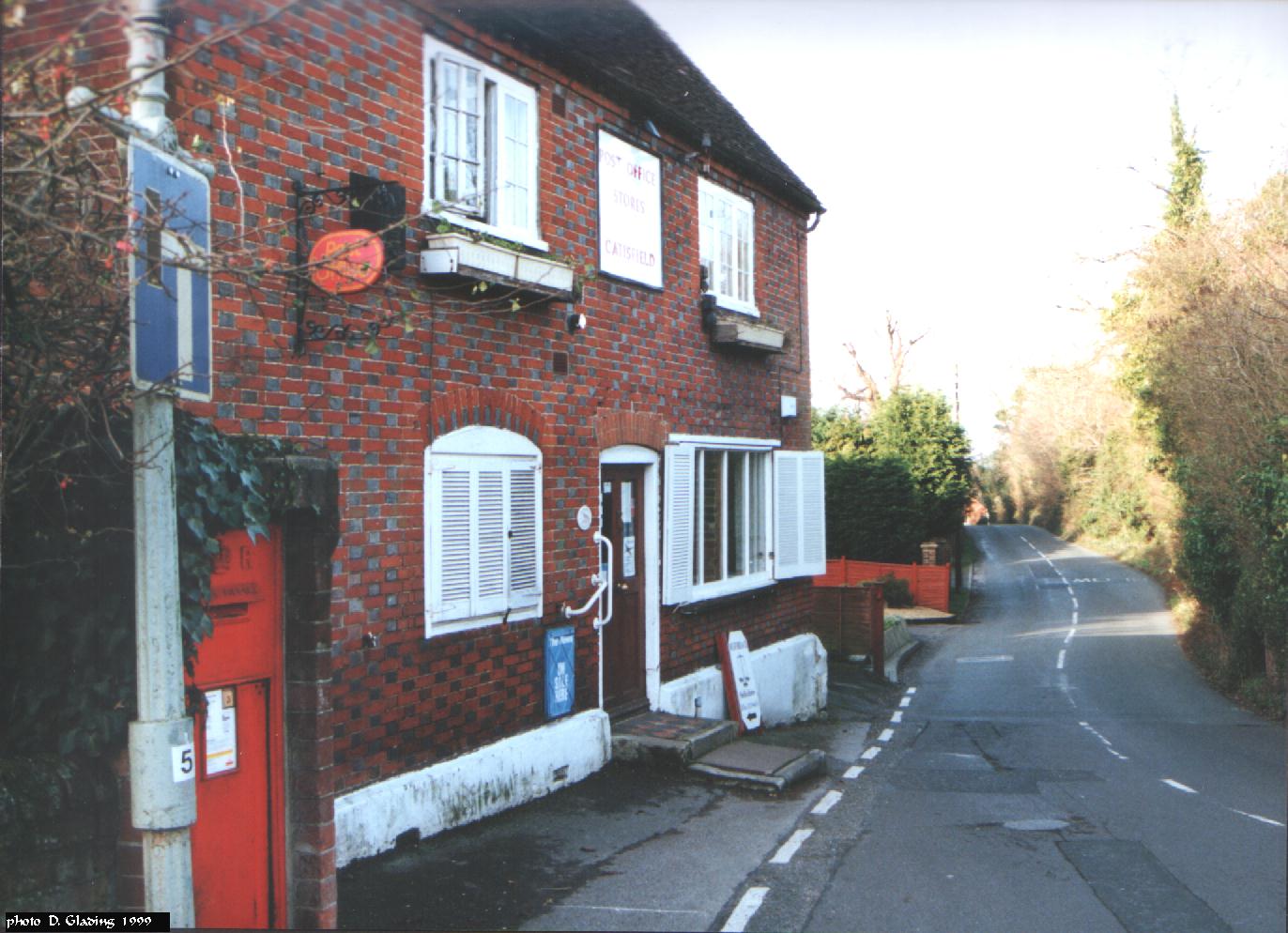
POST OFFICEThis is a well-known building, , however relatively little is known about it. The building was part of the Catisfield House Estate. A new sub-postoffice was opened in July 1900. In 1909 it was decided to limit the opening hours to 9.00am to 8.30pm(! ) Listed Building Grade 2 - thought to have been built about 1720. Address: 2 Fishers Hill
In the 1970s and 80s the Post Office was the hub and meeting place of Catisfield. If you wanted to know anything you popped along there. The very active shop part sold pretty well everything, including newspapers. There was even a Solicitor's office.
11/87 The Pecovers replace Mr & Mrs Burch, who had run the Post Office for 24 years .
|
click on any image to see larger version
|
||||||
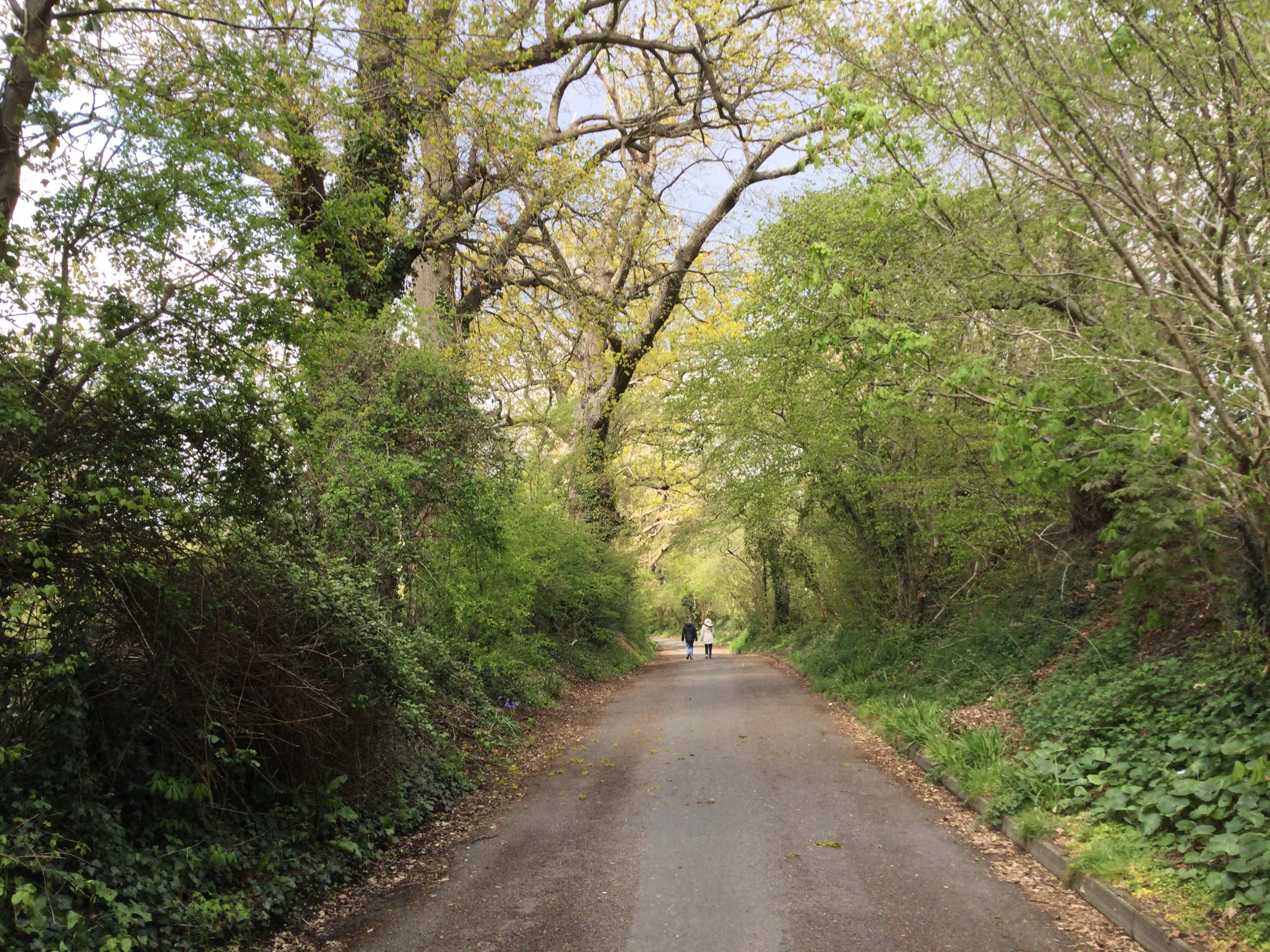
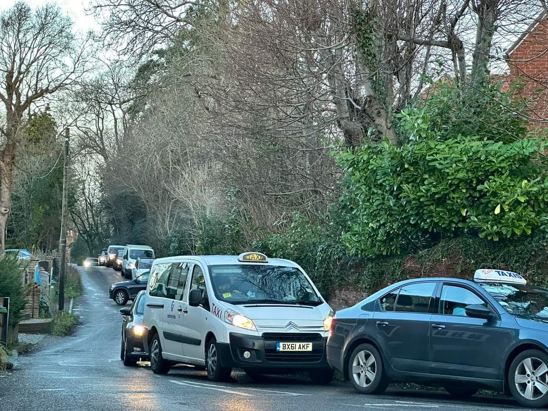
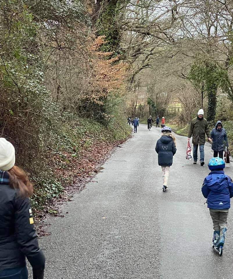
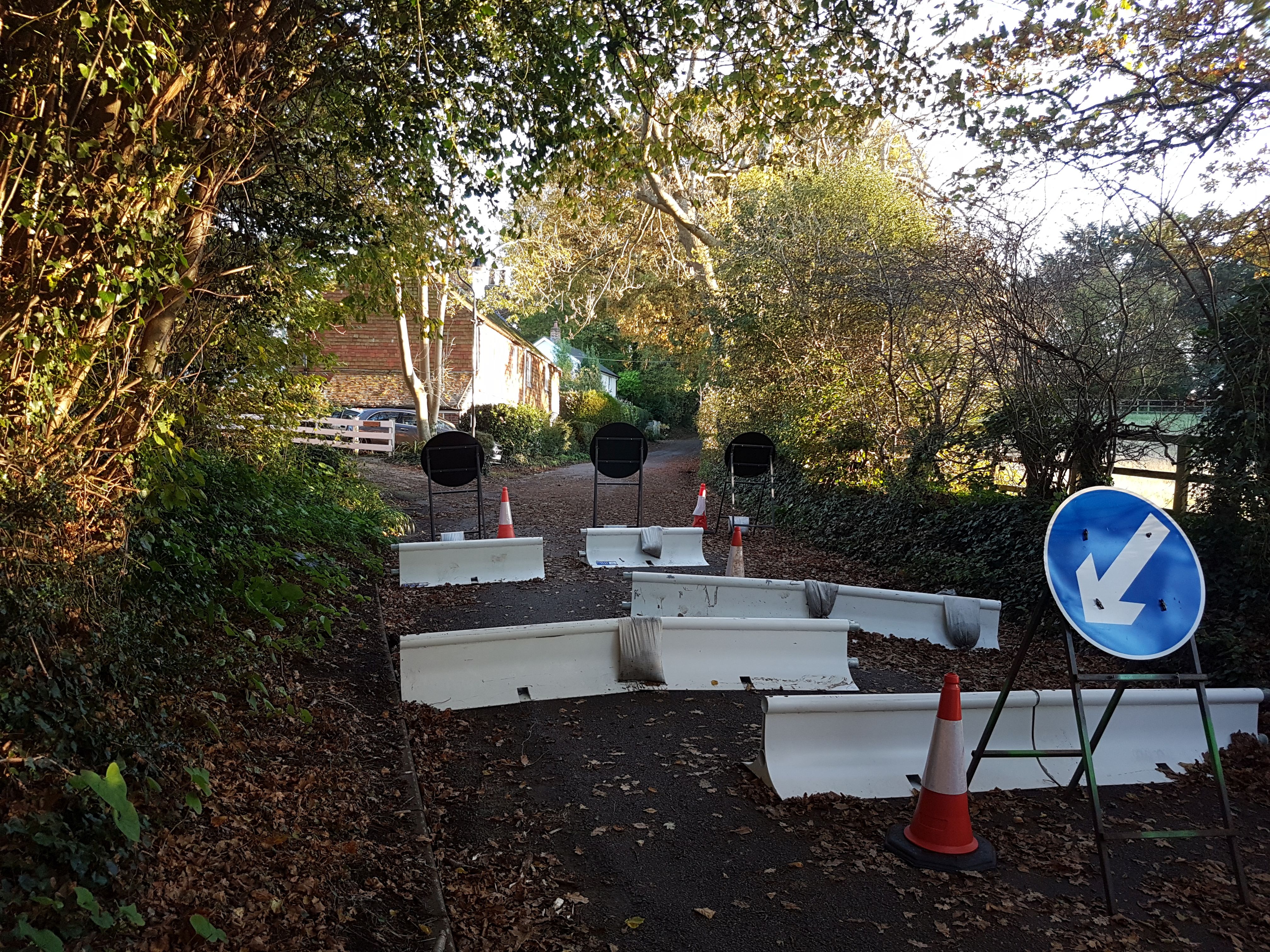
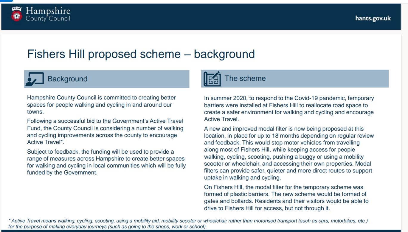
The Future of The Hill ??As of Aug2023 a decision is awaited on closing the hill to vehicles to allow it to be used as a healthy and peaceful and safe walk. The trial closure was very popular with pedestrians but not with motorists in their hurry. . .. . .[if Fishers Hill was still a nice straight road from Highlands down, think what speeds cars could reach ..]
|
click on any image to see larger version
|
.........................